July 1, 2010 -- East Rous to Eagle Island
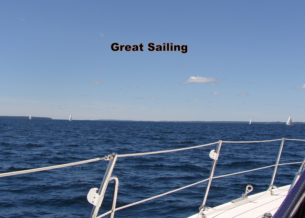
Finally able to get out of our nice protected harbor, we head west. Though the winds were still on the brisk side (20+ knots), they had veered enough so we could sail west, carefully picking our way below Rous and Bedford Islands, above Clapperton Island, and south of the Benjamins. We weren't sure where we were going but we were having a great sail and we were heading west.
Then, heading over Innes Island, the winds increased -- substantively. After reefing the jib and main (yes, we had 2 sails up) and very little discussion we decided we were cruisers and it was time to bail. We turned around and headed for Eagle Island which has a very well-protected cove on the northeast side. After a fast sail back east, we were shortly anchoring in the cove. While Day was lowering the anchor, she saw a mother moose with her calf watching her. (Unfortunately they were camera shy and left before we could get our cameras.) A great day sailing about 28 miles in 7 hours included weighing anchor and anchoring. We hit a max boat speed of 8 knots in 25 knots of wind.
July 4, 2010 -- Vidal Bay to Harbor Island, USA
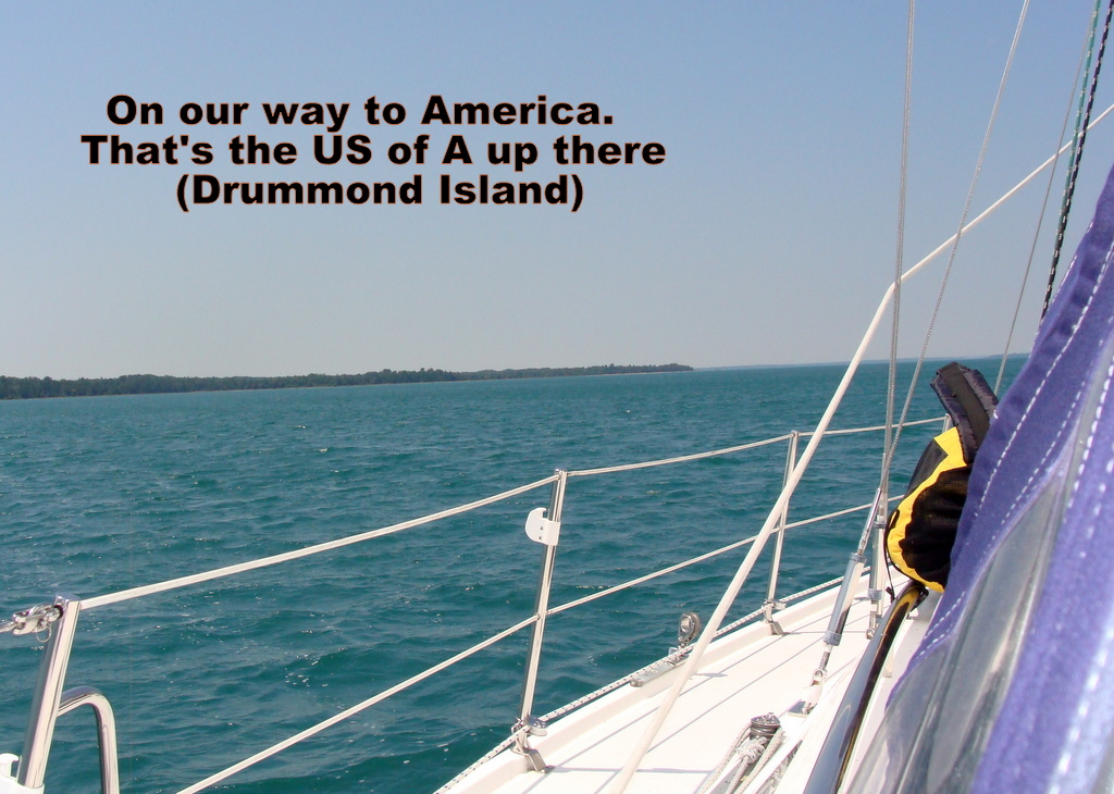 On our way to the USA. We sailed north of Manitoulin Island, Cockburn Island and Drummond Island before turning south toward Harbour Island (AKA Harbor Island on the U.S. charts). During the entire sail we "discussed" the proper way to check into the U.S. using our new NEXUS cards. Not to worry. We called, answered their questions, told them where we were going and got our clearance number, no problem. (We had taken discarded all of our veggies and stored all of the extra booze in IRV so duty was not an issue. Veggies are a problem crossing the border.) On this trip, we sailed most of the way but, heading south toward Harbor Island, we had to motor into the wind.
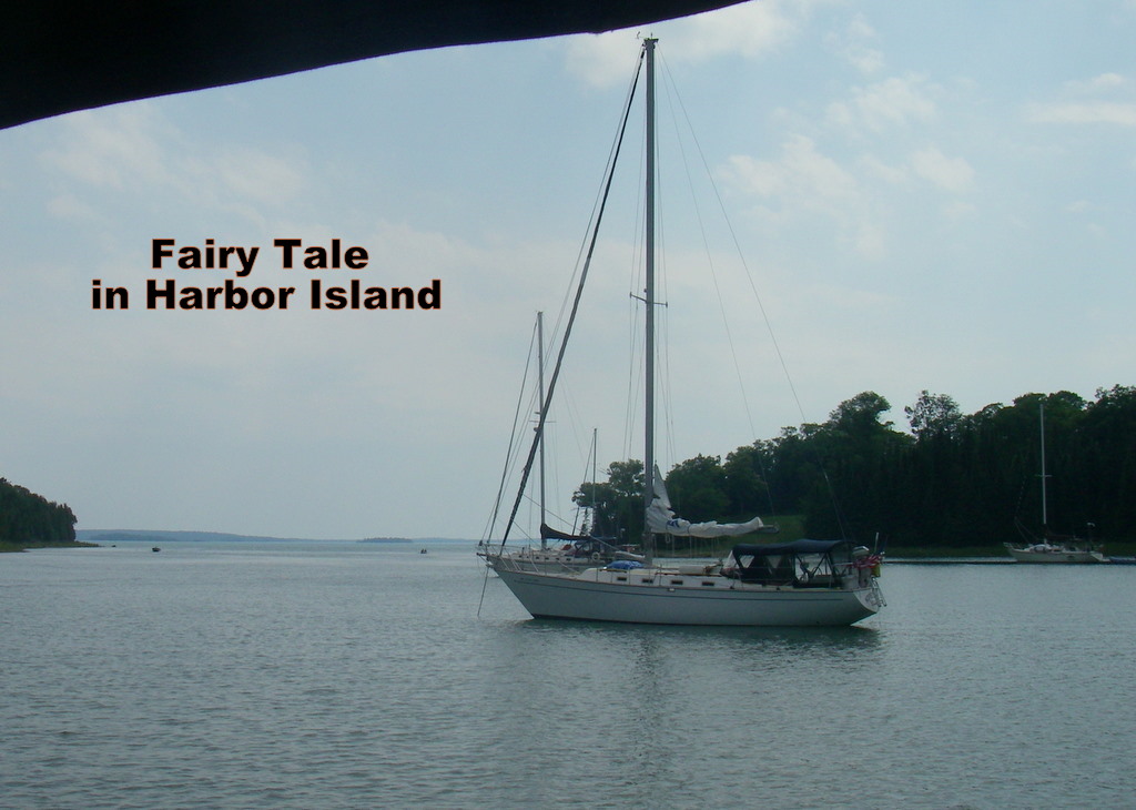 Once at anchor who should we see but Fairy Tale. Ted accused us of showing off when we swam over to visit and catch up on what they've been doing.
July 5, 2010 -- Harbor Island to Detour Village
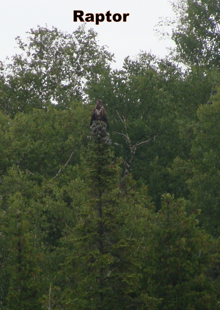 Not too nice of a day but we sailed (actually motored) out of the harbor anyway. On the way out we saw a big "Raptor" sitting in a tree at the harbor mouth. We circled around several times taking pictures and trying to decide what kind of bird it was. We first thought it was an immature Bald Eagle but now think it might have been an Osprey.
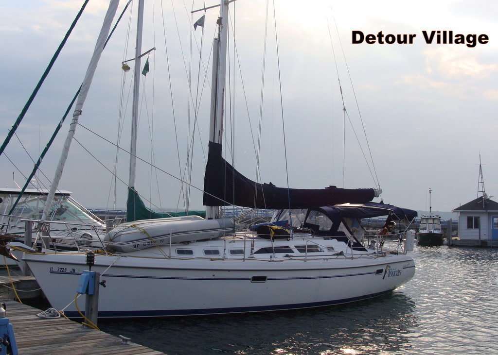 After this interruption (we weren't in a hurry anyway) we motored on in the light fog toward Detour Passage. Dodging a couple of freighters heading into and out of Lake Superior and with the fog getting thicker we decided to stop in Detour Village for the night. After stopping, the fog became so thick we couldn't see the freighters going by just outside the harbor mouth. (We were on the cell phone talking to Craig's mother when a freighter blew it's fog horn right outside the marina. We had to explain that WE WERE IN THE MARINA and were not about to be run over.)
July 6, 2010 -- Detour Village to Government Bay (Les Cheneaux Islands)
It was still hazy but visibility was good enough so we took off at about 10:35. The winds weren't all that strong (5 to 13 kts.) but we were able to sail some and motor/sail to Les Cheneaux Islands, pretty much straight west. After sailing the North Channel we are getting adventurous, we took the more adventuresome route the north of Martin, Pomeroy and Tobin Reefs and south of Surveyors Reef . Vision, Aerie and Champagne III were a couple of miles ahead of us and it looked like they took the safer route south of all of the reefs.
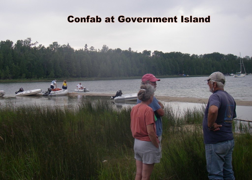
We anchored joining several boats in Government Bay and were soon joined by several more. Most of our neighbors were heading with us to the GLCC Rendezvous in Mackinaw City. There were more Canadian boats in the anchorage than Americans. Within an hour, there was a cocktail party planned with every boat's crew meeting on the beach for cocktails and hors d'oeuvres.
July 7 - 8, 2010 -- Government Bay
The 7th we woke to dense fog. Listening to the VHF radio, even the St. Mary's River and Locks (at Sault Ste Marie) were closed and the freighters were anchoring in the river. We decided to stay put. We could even hear ferries reporting their course to and from Mackinac Island -- they didn't stop running! An entertaining morning.
With several other crews, we dinghied over to Cedarville where we discovered the library was having a book sale. After all was said and done, Day left with 2 shopping bags of books paying only $5.00 . We had lunch, dinghied back to Government Bay and had another cocktail party on the beach. Cruising is such hard work.
The 8th, more fog. Several boats left anyway but, talking to them later, we were glad we stayed. Later the fog cleared somewhat and we were able to dinghy from Government Bay to Cedarville to Hessel and back through the small craft route. Even though the channel is well marked, we got lost. All was not lost as we saw some fabulous cottages and two Ospreys flying overhead. On the way back, we stopped in Cedarville for some groceries. While Day went shopping, Craig relaxed in Bumpas enjoying a beer. Craig felt entitled. He had worked hard driving the dinghy, and beers were only a $1.00. That night we invited Al (from Westwind, he was baching it) over for dinner. As most of the boats had left, there was no cocktail party this night.
July 9, 2010 -- Government Bay to Mackinaw City
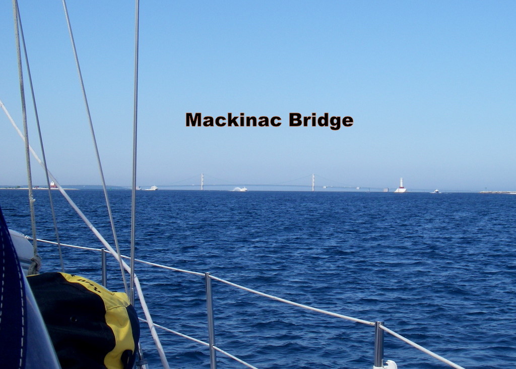
Up early - sunshine but no wind, we left anyway. The wind came up, slightly and the fog rolled in. Motor/sailing west, we were once again listening to all the Mackinac ferry boats giving Securitée calls because of the thick fog so Craig decided to turn the radar on. (By this time Craig had found a simple fix to the radar -- no new radar.) Finally, the fog lifted and we could see Mackinac Island straight ahead but still couldn't see anything to the north including the Nun marking the Goose Island Shoal that was less than a quarter mile to the north. After motoring between Mackinac Island and Round Island we headed south for Straits State Marina in Mackinaw City.
I (Craig) forgot to mention that we left our western Lake Huron Charts back home in the basement. We did have a chart book circa 2005, before the marina was built. Not knowing where we were going, we called for directions -- "The marina is between Coast Guard Cutter Mackinaw and 4 wind turbines to the south. Well, we found the Cutter and the 4 turbines and headed between them but only saw a concrete breakwater and no marina. At that time we saw a 100+ boat moving on the other side of the concrete breakwater. Ah Ha! We called saying we'd wait until that big boat got out of our way, and paid close attention to where it came out and headed in.
Straits State Marina is a brand new marina with great facilities and handy to downtown Mackinaw City. We were in Slip 67, right next to Vision, across the way from Aerie and down the dock from Fairy Tale. After registering for the Rendezvous and a cocktail party on Vision, we walked over to the Nonna Lisas Ristorante for supper (OK food but we had extremely bad service) and then called it a night.
July 16, 2010 -- Government Bay to Thessalon, Ontario
We left the Les Cheneauxs heading for the Detour Passage and Canada, we thought. We had a good sail, passing by the Detour light at about noon. Sailing up Detour Passage, we had to duck one ferry heading from Detour Village to Drummond Island and then barely missing another one making the return trip.
We thought we would check in to Canada using our new NEXUS cards and head for Milford Have, anchoring out. No such luck. We found out that we had to check in at a reporting station, Bruce Mines or Thessalon. By this time we were sailing pretty much downwind so it was easy to alter course, picking our way through the islands, reefs and rocks of Potagannissing Bay, past Burnt Island Reef Light, then taking a right to miss Salt Island before passing between North Seine Island and ODonnell Bank, altering course to head north by Perrique Island and finally heading to Thessalon. We should mention that we had our own little rain cloud that followed us all the way.
We got there about 17:00, checked into Canada and went to supper. It was worth the trip, we had a home cooked all you can eat whitefish dinner for $12.00 each including homemade dessert. Our own little rain cloud continued to follow us but it didn't dampen our enthusiasm.
July 17, 2010 -- Thessalon Marina to Clara Island
We left Thessalon and headed east. We weren't too sure about where we were headed but we were headed there fast. We were on a broad reach just smoking along through 1 meter waves and on autopilot. We had one problem, we were heading straight for McDonald Shoal and Mississagi Island. 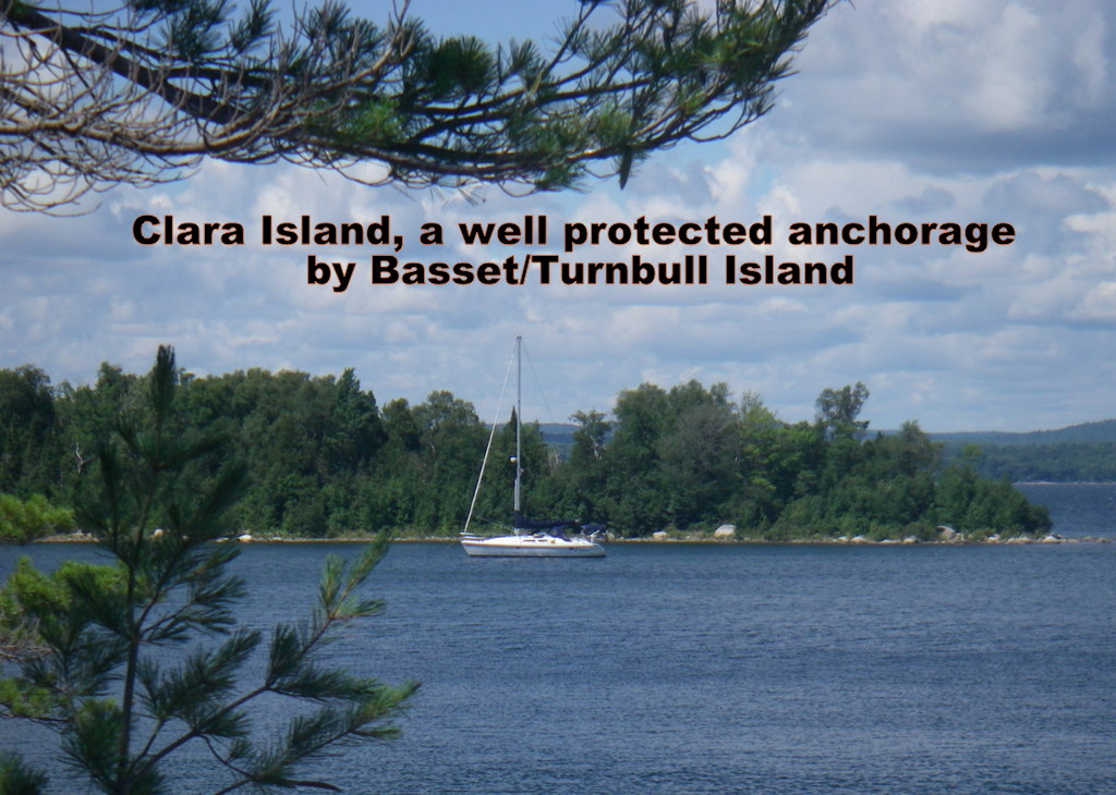 We had plenty of time to discuss our course and finally decided to head up a little, reef the jib, jibe around the island and head for Bassett-Turnbull. Another little problem, after jibing, it was so smooth in the relative calm of the lee of Mississagi Island, relative to the first part of the trip, we both almost fell asleep even though we were still sailing at over 6 to 7 knots. Waking up we heard Fairy Tale was at Clara (aka Sanford) Island, so we altered course for Clara. A fast sail (averaged 7 knots under jib alone).
We shared the anchorage with Adagio II, Fairy Tale and Class Act; after getting settled we got together for cocktails on Adagio II. A fun time was had by all.
July 18 - 19, 2010 -- Clara Island
Clara Island is well protected from west winds but is somewhat open to east winds and, of course, the predicted winds were east. The other boats left but the winds weren't predicted to be all that strong so we decided to stick it out, and the weatherman is always right isn't he?
The weatherman was right! We spent a lovely day kayaking, visiting boats over in the Turnbull anchorage and just messing around. Then it rained.
July 24, 2010 -- Oak Bay to Eaton Cove
Roy was hosting a Cruisers Net party on the 25th. Never ones to miss a party we were underway early, slipping out the east entrance of Oak Bay, unfurling the jib and rocketing down the McBean Channel by 09:00. The winds were really blowing and we were doing 6 to 7 knots in 20+ knot winds. Fortunately we were in the lee of East Rous Island as we beam reached down the Waubuno Channel, we didn't have to reef.
We pulled into Eaton Cove (aka behind Picnic Island) before noon but had a bit of a problem anchoring. We let out more chain than planned and got the rope to chain splice caught in the windless. Fortunately, we were anchored, so we tied off the chain, took the windless apart, cleared the jam and then put it back together in only 1 hour and 20 minutes. Afterwards we cleaned up and dinghied into Little Current to do some shopping and pick up Saturdays paper, our only source for news.
July 26, 2010 -- Eaton Cove to Burnt Island, Beaverstone Bay
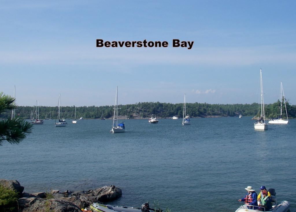 So much to do so little time. There wss a GLCC Wilderness Rally in Beaverstone Bay in Georgian Bay. We just have to get there. Believe it or not we were up and on our way before 07:30, fueled up, pumped out and made the 09:00 bridge. Once again we had favorable winds and sailed past Strawberry Island Light, north of Heywood Island, between Heywood Rock and Powell Cove Bank, south of Partridge Island leaving the North Channel and entering Georgian Bay. We then set a course for Beaverstone Bay but it went right over Green Island. Decision time, go south (and south of Scarecrow Island) in relatively clear waters or go north picking our way through the rocks under sail. The northern route was shorter, and since it was sunny, we went north. It was a bit of a challenge but was fun. We turned on the engine just before the entrance to Beaverstone Bay, took down the spinnaker sleeve (yea we used the spinnaker a little bit) and motored into the anchorage through more rocks and a few twists and turns.
We celebrated our arrival by having cocktails on the rocks with the GLCC'ers who were already there.
July 27 - 29, 2010 -- Beaverstone Bay, GLCC Wilderness Rally
Cocktail parties, potluck dinners, hotdog roasts, dinghy races, kayak races, exploration, gab fests, a good time was had by all.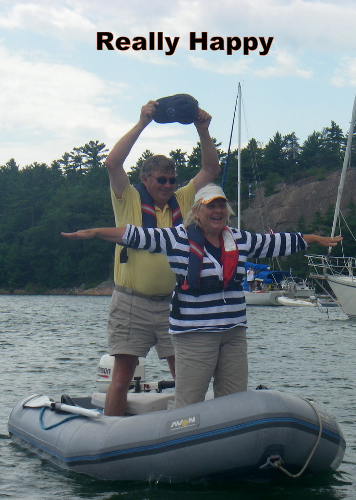
An unplanned event was the wind picking up to over 30+ knots from the west. Many boats decided to relocate closer to the bluffs to get some protection from the strong winds. We held out for awhile until we noticed that we were creeping eastward. The anchor was holding, kind of, but was slowly ploughing a furrow. Discretion told us to move before our anchor did. Weighing anchor in 30 knot winds is always interesting enough so to make it more exciting Day got her fingers caught in the windless. After she let out a loud yelp, Craig offered to get the anchor in but Day soldiered on (she later admitted to not wanting to take the helm). After securing the anchor she came back with a bloody hand bleeding all over everything including the logbook, messy, messy. We patched her up (using real tape not Duct Tape) and motored over toward the bluffs to re-anchor. We found a semi-protected spot in front of a power boat and anchored without the loss of any more blood. We found out later that the boat behind us was yelling on the radio that we were anchoring too close to him but we didn't have the radio on, ignorance is bliss -- We were NOT too close, so there.
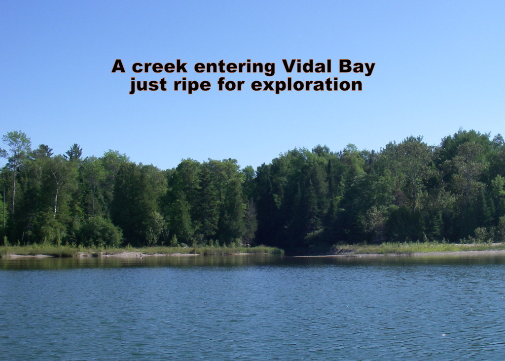
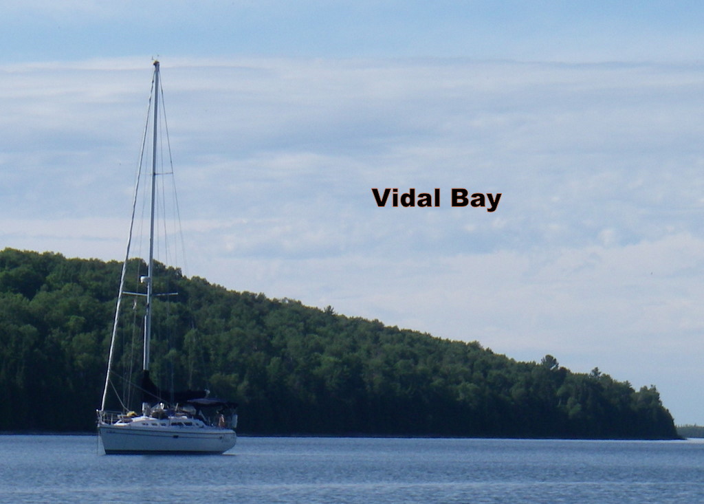 The winds were once again forecast to heavy, from the south. We were able to plan (really, we do make plans occasionally) a route to the north shore of Manitoulin Island and use the island to protect us from the worst of the winds. It worked! We tacked south between Innes and Darch Islands and, once we could lay the reefs south of Darch Island, headed southwest on a port tack toward Vidal Bay. We considered going into Bayfield Sound to anchor but encountered some really strong gusts coming out of Bayfield Sound and would have had to motor straight into it for several miles. We continued on and sailed into Vidal Bay at about 18:00.
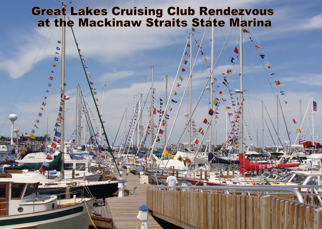 We had a great time at the Rendezvous. Every day was a different activity from a cocktail party on the Coast Guard Cutter Mackinaw to lunch at the Grand Hotel on Mackinac Island and a cocktail party at the Mackinac Island Yacht Club. The marinas facilities were outstanding as were our fellow rendezvous-ers.
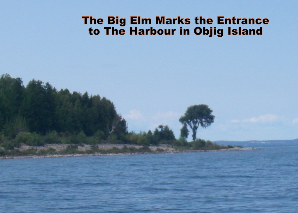 Around noon, we decided to leave and start heading back to the North Channel. Once again we had good winds for sailing but this time we were close hauled heading west. We weren't sure where we were going but after sailing on a starboard tack for a while we found that we could make Odjig Island without tacking too much. The entrance is a bit tricky having to almost touch shore by a big elm tree to get by a reef just off shore. Once in, its a lovely well protected anchorage.