July 2, 2009 -- Bustards anchorage to Terry's anchorage (near Nares Inlet)
If we are ever going to make it south of Parry Sound, we need to get going. We are up and actually get the anchor up by 09:00, wow! As we motor east of Pearl Island, we hear the end of the second official broadcast of the Cruisers Net for 2009 and are able to report our position as we leave the Gun Barrel. We join the Small Craft Route north of the Bustards in order to get out of the rocks and then, leaving the route, pass through even more rocks east of the Bustard Islands into the open waters of Georgian Bay. After making it out, we actually put up the main for the first time -- only one small glitch, Craig had twisted the reef lines when he tied them in at Harbor Vue. The main and, occasionally the jib, stay up until we reach the buoy leading us into the Pointe Au Baril channel. The sail is great with boat speeds of 1.5 to 6.15 knots and wind speeds to 22+ knots. It's even nice and warm -- until we near the entrance to the Pointe Au Baril rocks.
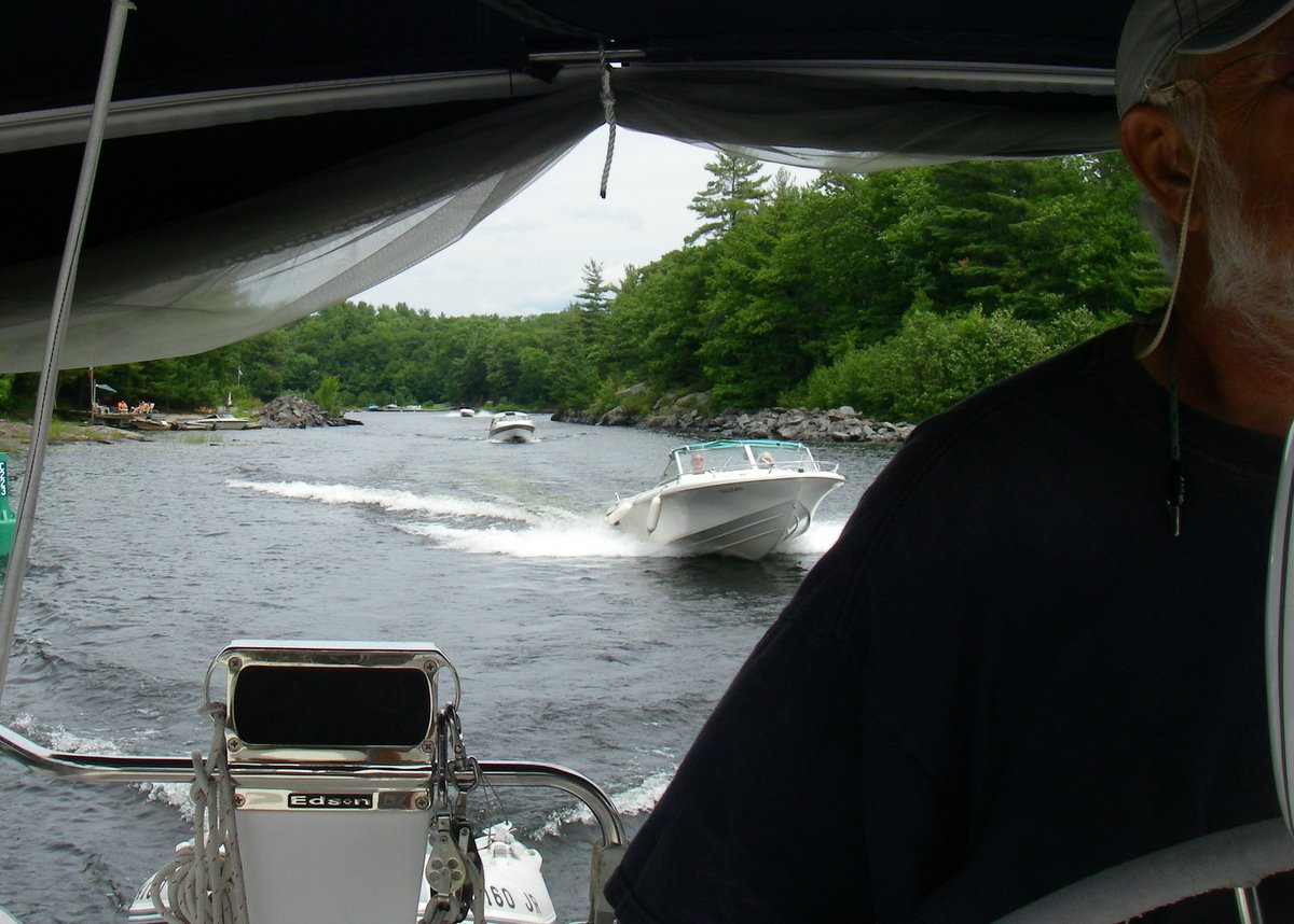
 At the outer Pointe Au Baril mark, we take the main down first leaving the jib up -- a mistake. The jib´s clew keeps hitting Day´s glasses off as she tries to get the main down, ruining her day, Craig heard about that for the rest of the trip. After sails are finally stowed, we head in on the range to the Small-Craft Route (GLCC reports state that if you are at 105 degrees and not on the range, get out of there because you are not where you think you are). When Craig ask where we are supposed to turn, Day doesn't know -- not panicking but close. We think we are near the turning mark but it is not the buoy she thinks it is. With a quick review of the charts, Day determines we have to turn NOW. At this time, the wind decides to get stronger from the beam and starts to push us to starboard toward charted 4 foot depths. Craig steers to port where Day notes that there are even shallower depths -- more panic ensues. Finally Day finds the range marker which Craig is supposed to follow. All is well -- until passing the first green buoy. The next green buoy is next to rocks (on the port) and the following red buoy is close by with 3 foot depths. It is close quarters and, just after the red buoy, is a quick turn to starboard. We make it. After all that, it is fairly simple so long as we keep the buoys to the proper side.
Finding the anchorage is easy in comparison. After scouting the area, we anchor in 9.5 feet of water (it only takes two tries to get the anchor down this time) ending up 10 to 20 feet from shore next to a big rock that is just under water. We had found a well protected anchorage shared with only 2 powerboats tied to shore. For some reason we don't take any pictures on the way in.
July 5-6, 2009 -- Eureka Point anchorage
 It´s a bright and sunny day and we decide to look for fish and chips. We heard that there is a good fish and chips stand at Pointe Au Baril Station and, even better, they have a garbage and recycling spot. We load the garbage, recyclables, GPS, chart, camera and ourselves into the dinghy and take off, like the rest of the cottagers, fast on a plane. Craig zooms around and only slows down to miss 2 boats coming through a narrow deep passage. The second boat calls over and asks if are from the sailboat by Eureka Point -- Are we that transparent?
Once we get through the narrows, Craig opens it up once more and zooms off. Day tries to navigate in the bouncing dinghy -- big mistake. We end up in a dead end where the GPS and chart seem to be at odds, throwing Day for a loop. Craig to the rescue, zooms around finding his way out by eyeball navigation. Day, now using line of sight rather than charts, takes us through a narrow and shallow area to the Ojibway Club on Ojibway Island. There is a gas station, grocery store, ice cream and ice but we don´t stop -- we want fish.
 To get to Pointe Au Baril Station, we have to cross to the Small-Craft Route and take an alternative route, but as we start out there is this big blue powerboat heading straight for us. Craig alters course, so does big blue powerboat. We change again, so does the big blue powerboat. Finally the big blue powerboat realizes he is no longer in the Small-Craft Route and he is heading for a dinghy (us) which only draws inches and -- there are rocks everywhere. He slows down rapidly, turns sharply and cuts off a smaller boat that has to immediately swerve to miss the big blue boat. Oh well. No harm done.
We continue to meander our way toward the fish -- on a plane (Craig likes to go fast, a closet power boater, maybe). We make it to Pointe Au Baril Station and stop at a dock which turns out to be a "waste drop off only" dock. We tie up the dinghy and start to take the garbage etc. to the dumpster, when a guy and gal come down and take it from us. They are efficient! It goes directly to a compacting area and later to the dump (any empty liquor bottles claimed by anyone who is willing to take them 20 miles for the return money). After ridding ourselves of the garbage, we go to the wharf to find a head and the fish. Walking 3 blocks under the railroad bridge to Hwy. 69 to the Shell Station, we find a head, a Saturday newspaper and the Fish Shack for lunch.
After eating and reading part of the paper, we head back to the dinghy. Now there are a lot of boats coming at us up the channel. We guess that people are either returning to go home or spouses are dropping off the wage earner and then taking the kids back to the cottage. As we return, Day recognizes the areas and doesn´t have to use the charts too much. Once, Craig wants to head west instead of south when we reach the Small-Craft Route but Day stands her ground and we find Toucan waiting for us. Now it is time to read the Saturday newspaper and for a nap. Another boat, Vision 1 (with a dinghy named Glimpse), enters the anchorage and anchors just inboard of us. It is nice and warm for a change -- probably 25 degrees.
The next day we wake up to rain and cold weather -- 13 degrees. With maybe a high of 15 degrees we stay at anchor, worked on pictures, locations and this report. The new window for companionway does keep us fairly warm. We spend a really boring day with rain until 15:00 and maybe 15 minutes of sunshine. Toucan stays warm but windows steam up as the interior becomes cozier. Maira, a Beneteau, anchors outboard of us.
July 7, 2009 -- Eureka Point to Big Sound Marina in Parry Sound, Ontario
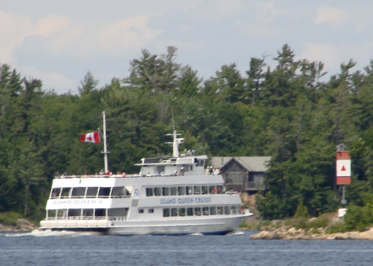
It is 12 degrees and wet. Not wanting to stay below and veg for 2 days straight, we up anchor at 09:30 (the Beneteau has already left), and are off to another anchorage or, depending on our endurance and the weather, a dock in Parry Sound. We pass Turning Island and head for Twin Sister Islands in Shawanaga Inlet.  Our intention was to turn into the Small-Craft Route passing through a narrow channel towards Regatta Bay/Snug Harbor anchorages but Craig sees a dotted line on the chart plotter that looks shorter and easier to follow. Luckily, Day has already checked the GLCC report, the Georgian Bay Sailing Instructions, and the charts so it only takes her 5 minutes or so before she says it would save at least 3 miles and avoid the narrow channel next to Narrows Island. By this time Craig has over stood the 180 degree course to Red Rock Light and has to maneuver back so we will pass over a 30 foot deep ledge, really. This ledge will tell us where to turn to intercept the steamer route into Parry Sound. By taking this route, we will bypass the Regatta Bay anchorage but by this time, in cloudy skies, cold, intermittent mist and rain, we are ready to go in for a night at the dock. The only downside is that we are more exposed to the stronger winds and building waves from offshore in Georgian Bay. We find the ledge, make the turn and jog up to the second range. The only problem is Craig getting lost and trying to head into some rocks and islands. Day straightens him out and we finally head between Kilbear Point and Rose Island into the waters of Parry Sound. Passing Kilbear Point, we see the Island Queen, a 125 foot tour boat heading directly for us.
  We pass port to port and, bypassing much of the rain and/or heavy mist, head the 8 miles to the city of Parry Sound. Approaching the entrance, we encounter about 40 laser type boats. There is a 4 day junior sailing regatta on 2 courses in 20 knots of wind right in the middle of the entrance to the city of Parry Sound. After carefully passing through the regatta, we make a sharp left turn past a floating breakwater into Big Sound Marina and tie up next to Friday's Child, a C&C 29, who we met last year in Bad River.
Tying Toucan to the dock, we immediately head to the showers to warm up. The showers feel good but we had to keep hitting a button knob to keep the water running (it would only run for about a minute after pushing the button). After finally warming up, we walk uptown.  Since it is Tuesday night, we are able to see the start of an old car show and, walking back, we notice a brass band giving a free performance at the Charles Stockey Performing Arts Center (inside because it is so cold). We decide to bypass the concert as we need food and would probably fall asleep anyway.
After supper, we wake up a bit, and go back to see the old cars. We shouldn´t have; it made us feel old. The first two cars Craig owned are there along with the first car Day legally drove. To revive our spirits we walk over to the seaplane terminal to get ice cream (Georgian Bay Airlines: they offer a Fly n´ Dine which flies to Henry´s Restaurant on Frying Pan Island). The ice cream place puts up the closed sign 15 minutes early but people ignore the sign and get ice cream anyway, local knowledge. After our ice cream, we go back to the marina to check email but the mosquitoes drive us back to the boat (the only place to get on the Internet is outside of the marina office at a picnic table).
July 8-9, 2009 -- Big Sound Marina at Parry Sound
We both have email to deal with but Liz from Friday´s Child and Linda from Crescendo had ordered a cab to go to Sobey´s for groceries ($8 each way) and ask Day if she wants to tag along. Definitely -- we need fresh foods. Craig stays at the picnic table with Mike and Greg as the three of them play with their computers. By the time the gals get back, 5 boats that had met at Bad River in 2008 are in the harbor -- Friday´s Child, Crescendo, Toucan, Hart Tug and Steve and Fran´s new Nordic Tug (they had a sailboat last year) -- serendipity. After putting away the groceries, we don't get anything else done. We exchange photographs from last year, assist with sail repairs, trade recipes and visit; Linda makes the best coffee. We finish off an enjoyable day with a spur of the moment Happy Hour on Crescendo. After which we head up to a cafe for a hamburger.
The main reason that we didn´t want to miss Parry Sound is that we want to visit with Dave Thomas. Craig and his family (and Day after they were married) had spent vacations at Dave´s cottage on Huckleberry Island in the late 60s and early 70s (he has since sold it). After Craig calls Mr. Thomas, Dave drove down to the harbor and about 15 minutes later we were visiting and reminiscing and having a great time.
After Dave left, while checking email and the Internet, we met Randy from Prime Time V. We had emptied one of our propane tanks and, as luck would have it, Randy is taking his propane tank to Canadian Tire to be filled. Craig tags along with his empty tank but Canadian Tire wouldn´t refill it; it was over 10 years old and the tank has to be recertified. By the time Craig gets back to the harbor with his empty tank, Day has learned that Sobey´s offers a free shuttle from the marina and wants to go back to get some meat.  Oz, Sobey´s shuttle driver (Day´s not in Kansas anymore), takes Day to Sobey´s via the scenic route surreptitiously dropping Craig off on the way. Once Day finishes shopping, Oz picks her up and picks up Craig at the propane dealers and drives them back to the harbor. After resolving our problem propane tank, we visit with Greg and Linda and meet their daughter and son-in-law. Later in the day, Randy and Nancy from Prime Time V come by and we pick their brains for spots to visit in the area west of Parry Sound until the mosquitoes drive us back to our respective boats.
July 10, 2009 -- Parry Sound to Three Finger Bay (aka Five Finger Bay) anchorage
 We are up early for once but still don´t leave the dock until 11.26. We take our charts over to Prime Time V for more information on where to go in the 30,000 islands of Georgian Bay east of Parry Sound -- very, very helpful. Taking their advice, we decide to head for Three Finger Bay (aka Five Finger Bay) about 15 miles east of Parry Sound via the Small-Craft Route.
  But we must first fill the water, diesel and dinghy gas tanks and pump out the fluid that we have accumulated. Amazingly Parry Sound doesn't have any services that we can get into (depth) so we head across the water to Sound Boatworks.
 To get to the South Channel to Frying Pan Island, we have to pass through a swing bridge and, while waiting for the bridge to open, brave all of the small powerboat wakes. It opens 5 or so minutes late to accommodate a barge heading toward us. Now the hard part, we have to navigate through many narrow passages and lots of buoys, islands, rocks and inconsiderate runabouts. Our first challenge is to get through 2 Mile Narrows -- 45 feet wide with a bend just before entering that doesn´t allow you to see boats coming from either direction and with the added challenge of small boats roaring through at 10-20 knots. Then comes 5 Mile Narrows followed by7 Mile Narrows (49 feet wide, and 9 foot depth) and then Devil´s Knee (one boat only but visibility is good).
 While we are traversing 7 Mile Narrows and we meet the Chippewa II (a tour boat) in the worst area -- no buoys and rocks close by, but she sees us coming and waits for us. We thank the captain while all of the passengers take our picture. After Devil's Knee we have to find the right island, appropriately named Turning Island, marking the turn to Frying Pan Island -- by this time all islands look alike. Just as we identify Turning Island, we see the Island Queen heading into the route we just exited. Boy, were we glad to be out of there.
 After reaching Frying Pan Island, we have to wind our way northeast to Massasauga Provincial Park and our anchorage. We leave the Small-Craft Route, going by a big rock to port and heading to Anker Pint (actual name printed on a rock).
  Anker Pint is a very narrow, shallow (6.5 feet at LWD) passage between a rock and hard place. We are moving ahead very slowly with Day on the bow when she sees what appeared to be a very shallow rock and yells to Craig to turn to starboard -- NOW! We miss the rock by inches. We will leave by an alternate route. Now we follow Randy's directions to avoid a nasty shoal area, kind of marked by a couple of milk jugs, by going around an island and then through a few visible rocks to a well protected anchorage.
July 11-15, 2009 -- Three Finger Bay anchorage
 It rains all night and into the morning so we wait until after lunch before heading out in the dinghy. After exploring all of the fingers of the bay, we head to Henry´s Restaurant at San Souci on Frying Pan Island. On the way, we check the depth at Anker Pint finding out that the rock IS 3.3 feet under water (Toucan would have hit it.)
  We have to stay in the center favoring the starboard side when heading up bound). The wind is blowing hard from the south and, heading into the wind and waves, it is a very wet ride to Henry´s. We couldn´t justify eating fish and chips at 15:00 so we have to settle for superb butter tarts and a soda. Leaving Henry´s, we head around the point to the island's grocery store, post office, gas station and LCBO. We mail post cards and buy a Saturday newspaper ($3.50 for the large weekend edition) and prepare for the wet ride back to Toucan. With the wind to our backs, it turns out to be a drier ride with lots of sunshine. No boats anchor near us while we are gone but at dusk a powerboat anchor right at the entrance to the open area, but later move into one of the fingers.
We wake on the next day to sunshine and Craig heads out early to fish. He hooks a Northern but it steals his lure. Fish -- 1; Craig -- 0. No further action so no fish dinner. After lunch, we once again head out in the dinghy. This time we go east -- we think -- all of the charts of the area are printed cockeyed. We go as far as we can go by water and find a couple of portages to inland lakes but we don´t do portages. We then head south to check out another anchorage but it is very open to the north and west, we won´t move. We also check out the Ritchey Bay anchorage which is just to the west of an island that has a mansion, a newfangled windmill and a boat house bigger than many of the cottages around here. Now to find our way back to Toucan. After much thought and discussion, Day gets us home.
The next day, Craig is up early once again to fish but still doesn´t caught us dinner. We read until noon when the sun finally comes out and we get into the dinghy. This time we want to go to Woods Bay and beyond it to the Moon River waterfall. When we reach the open water of Woods Bay, a large uncharted area, the southwest wind at our backs is building. Craig is concerned about getting back against the wind and decides that we had better head back before it gets any worse. Heading home, to make the trip shorter, we cut through some very weedy areas and once out of Woods Bay find that we are protected from the wind. Not ready to go home, we check out the anchorages by Port Rawson Bay. We find a couple of really nice protected areas; one does not have any boats; another has 5 boats but has room for more. This time, we have an easy time getting back to Toucan.
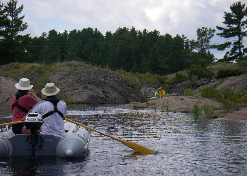
Craig continues his morning fishing and this time gets a keeper, fish for supper. After breakfast and an hour of battery charging, Craig makes sandwiches, packs drinks in a collapsible cooker and we head out (around 11:30) motoring at 15 knots in the dinghy with a couple of charts, a GPS and a compass. Today, the wind has moderated, so maybe we can make it to Moon River waterfall. We make it through Woods Bay stopping at Moon Basin Marina still looking for a couple of charts (which they don´t have).  Now to head for Moon River. Day has her old, trusty chart and boldly leads us where we have never been before. We follow the coastline rather than the straight line path and get into some rocky areas but keep going. The rest of the trip to the mouth of Moon River is uneventful though it takes us a while to find the mouth, we actually follow a canoe into the rocky entrance to Moon River and then successfully navigate around rocks and a tree to about a half mile from the waterfall. There are at least 4 boats tied ashore so we join them and hike over the smooth rocks to the falls. We hike by some young boys, who are camping at the falls and swimming in a pool.
  Further up another group of college age men and women are jumping into the rushing waters of the falls and letting the rushing water carry them back to shore. We don't jump into the falls but sit down, have lunch and watch all of the activity. A friendly dog tries to take our lunch but we are able to fend him off. After an hour or so we head back to the dinghy.
At 14:30, we start to head back to Toucan, about 9 miles as the crow flies but not as the dinghy goes. This time we decide to bypass Woods Bay with its white caps (the wind came up again) and take the Captain Allan Strait. After Day tries to take a shortcut that is full of weeds and is nonexistent, we find the Strait and head through, a short passage which is fairly deep, if you miss the 2 foot rocks at the exit. We check out an anchorage on the way which is okay but with way too many cottages around. Time to get home, so we head west towards the bottom of Moon Island; find the red buoy on the chart and Day, thinking she knows where she is, tells Craig to head northwest. Unfortunately, that passage does not go through. We then try to go around an island, but that area is foul with rocks everywhere. We meander our way through the rocks going slow because the wind and waves are really building. Day then decides we must go south and east to go north and west; Day´s navigation is getting weirder, at best. We bravely head south and east hoping we can find a passage that will let us head north and west to Toucan. Using the GPS, Day now thinks she knows where we are and says to head west to find a passage north. After lots of rocks we finally see some sailboats passing to our starboard. Thinking they must be heading for Toucan, we try to get to them but it is too rocky. We then head around the next island to find 3 foot waves in our face in what seems to be in the open waters of Georgian Bay. We can´t continue this way so we wind our way back through rocks to where we had come from (it's now 17:00). Now going with the wind and waves, Craig keeps asking where we are, but Day admits (a first) she has no idea. Finding a sheltered bay where we can spread the chart, Craig takes over the navigation and after 15-20 minutes, and the use of a hand bearing compass, a GPS position and navigational landmarks on the charts, he determines that we are on the south side of Iona Island (where we were a half hour ago). Craig plans a route to go over the top of Iona Island and Jerves Island and just before another red buoy to take Moon Island to our starboard and Bernard Island to our port and then head left to take the top of Crooked Island to our port and Pennsylvania Island to our starboard, wow. After passing over the top of Crooked Island; we are finally in familiar waters we had passed through 2 days ago and are back on Toucan by 18:00. Our return from Moon River Falls covers 16.9 miles and took 3 1/2 hours (our trip to the falls was about 10 miles and 1 1/2 hours, our portable GPS keeps track). It is good to be back.
 Today, we are going to get a meal of fish and chips at Henry´s at San Souci on Frying Pan Island -- we need dinghy gas, our excuse. The winds have moderated and it is not as wet as we head south but now the powerboat waves rock us as we pass through Anker Pint and head through the open areas toward Henry´s. Henry´s is known for their Fish & Chips and we have a superb meal of pickerel (walleye) served family style. There are 5 filets each -- fried in a very light batter -- a huge basket of french fries, coleslaw, baked beans and a warm roll each and a couple of large sodas. It isn´t cheap, $40, but a good price for what you get. We take a filet each and most of the french fries back to Toucan for supper.
When we stop for gasoline at the dock, the dock boy said everybody takes food home but "with the dip in the economy, they just don´t serve as big a portion at the restaurant anymore". Gas at Henry´s is also expensive $1.55 per liter and there is no diesel. Maybe it has something to do with being on an island and everything has to arrive by boat. We stop by the grocery store on the island to see if they have the two charts we are missing but no luck; the charts they had are newer than ours but the only charts they had are ones that came with the store when they bought it 18 years ago, ours are 40 years old.
We make it back to Toucan just as a light rain begins to fall and we put out a worm. We expect to rest while little fish eat the worms. (The worms are still from Wally´s which we bought around June 19.) Within a couple of minutes Day hooks a decent size bass, fouls up the reel (as usual) but lands the fish. We continue to fish but no more. Leftovers from Henry´s tonight and a fish supper tomorrow.
Lots of rain, thunder and lightning overnight. Weather is still cool but that makes for wonderful sleeping. Jeans, long sleeves and sweatshirts are getting to be normal wear.
July 16, 2009 -- Five Finger Bay anchorage to Kilcoursie Bay in Kilbear Provincial Park
06:00 Day wakes up to dense fog and not being able to see the rocks marking the way out of the anchorage goes back to sleep. By 08:00, fog has dissipated and, after breakfast, we up anchor and head for Georgian Bay and hopefully, a day of sailing. We decide to avoid Anker Pint and head south, picking our way out with Hewson Island and Ardwell Island to our starboard and Davis Island to port. Day tries to plan ahead but her predetermined waypoint is not valid and, to get south, we have to use the chart plotter, line of sight and by guess by golly hoping there are no uncharted rocks. When we finally cross the Small-Craft Route and pass Double Island and Burkett Rocks into the bay, we run into lots of waves and wind. While Day is down below plotting our way out into the open waters, Craig is at the helm getting colder by the minute. After Day comes topside saying our route is motoring straight into the winds and waves, Craig, who has been watching the waves build and is freezing, suggests that we go inland along the Small-Craft Route. Day doesn't disagree and Craig, thankfully, turns around.

It´s still windy and cold but at least the waves aren´t as bad. Craig finally gives up standing in the cold wind and Day takes the helm as we head toward Turning Island. Entering the narrow area between Bear Head and Campbell Island, Day gives the helm back to Craig and starts to watch out for rocks and buoys. Then in a fairly easy channel to navigate, Day goes below to make coffee and when she returns, Craig has a question: "Do we go between the red buoy to starboard and the milk jug to port?" Staring at the "milk jug", Day sees that it is not a milk jug but a green buoy that has the top eaten off and says "go between". That´s not all. She also notes that the numbers on the buoys don´t match the chart but the route matches so after a few moments of panic, she decides we continue on. When she recognizes Jack Island (really tough since someone had painted the name on the island) and realizes she is looking at the wrong chart. More panic until we pass by Jack Island and Kathleen Island and reach the area that she thought she was directing Craig through.

Deciding to take the main route through Long Sault instead of an alternate route through lots of islands, we pass through a buoyed narrow opening and resolutely head for the next set of buoys -- a red day marker on the right, a short turn to miss the next red buoy, then a turn to miss the green buoy, then hug the next red buoy and THEN we pass through another pair just wide enough to let Toucan pass through, whew. We finally make it through with Day continuously on the bow watching rocks passing by close to port and starboard. Was this the right way to go versus the alternate route? Who knows but another sailboat followed us through and we met 3 or 4 power boats going the other way looking as anxious as we felt. The majority of the passage is only wide enough for one boat but luckily we do not meet anyone except in wider areas.
The rest of the way is easier to navigate but still cold. At least we are now near the end.  In an open area and Craig puts on autopilot as and sits down to get warm when Day then looks to port and says "looks at those sailboats, isn´t that where are going?" It is Kilcoursie Bay, our destination. Finding a "not so deep" spot, which is out of the designated anchorage, we set the anchor in sand next to Island Spirit -- another Catalina 380. That evening, Paul and Wendy, from Island Spirit, and their 2 dogs come over for a visit.
July 17, 2009 -- Kilcoursie Bay anchorage in Kilbear Provincial Park
Another partly cloudy day (more clouds than sun) but we don´t let that stop us. After a visit with Island Spirit, checking out their canvas enclosure and discussing, among other things, what to do in the park (and they gave us an SOS pad, our rub rail needs cleaning), we head to shore to walk through the campground -- nice sites with everything from tents to Class A motorhomes. Facilities include flush toilets, showers and a laundry (all sites are full with new campers arriving as soon as others leave).
Day is nervous using Craig´s Dad´s 1973 charts of Parry Sound and since Kilbear Marina is not that far away (in a planing dinghy). Day asks tells Craig we are going to the Kilbear Marina, in the rain, to shop. The marina has a small grocery store, a restaurant, nice docks (check depth before heading in), fuel -- diesel 95 cents a liter and gasoline 1.15 per liter, a fairly complete ships store and charts. We find out that Canada has replaced our old Parry Sound chart with 2 new charts. Fortunately, we get a garbage bay to protect our new charts and the bread and eggs as we head back to Toucan, as the rain starts as soon as we leave.

Craig finally finishes installing "Day´s" Ham (and single band) radio, the skies clear and off we go to Huckleberry Island -- 8 miles away. Craig spent a few summer vacations on Huckleberry in the 60´s with his folks in a cottage that Dave Thomas used to own.  Day once again tries to send Craig in the wrong direction but Craig´s memory is still not that bad and he knows the way to the bay. The cottage and dock are still there and look the same as they did 36 years ago. After many pictures, we head towards Hole in the Wall, a 1/4 mile long and a 50 foot wide passage which provides a shortcut from Parry Sound to the cottage (it doesn´t seem as narrow as it did 36 years ago). Progress, there are now day markers marking the entrance to the Hole in the Wall and the rocks that regularly ate part of Craig´s father´s prop. It is here that Day hooked and lost a large Northern along with Craig's favorite lure. He has never let her forget it, 37 years and counting.

Returning to Kilcoursie Bay, we go ashore to pay the park fees. We thought the fee was $10 but finding out that it was $13 we had to go back to Toucan for more money. Day uses all the change we have (except for quarters and loonies as used for laundry) and, since we are paying for it, we take our garbage ashore.
July 19-21, 2009 -- Northeast anchorage
Craig from Windigo notices the Ham antenna on our back stay and comes by to visit and talk about it. Since he´s a real Ham, we ask him to come back for cocktails at 17:00 (a bribe?) and to check out our installation. We then head out to explore the area but Dave invites us aboard R-Leg-A-Sea for "a" beer. A couple of hours later we take John back to Muddy Wench and head back to Toucan. More boats are arriving with a small Hunter trying to anchor on top of our anchor. When that doesn´t work he tries to anchor right next to Windigo. Craig from Windigo calls over that they will be coming over, Day yells back, "Good" and the Hunter leaves and anchors across the bay. After a beer, Windigo Craig checks out the Ham Radio, makes a contact in Richmond, Virginia and pronounces the installation excellent. Craig and Cindy head off to try for more fish and we head out in the dinghy to see who else is in the anchorage -- there are 11 boats anchored around us. We visit awhile with Aerie -- we met them in Bad River last year.
The next day everybody leaves but Gentle Pressure. As we didn't get to do any exploring yesterday, we get in the kayaks and paddle around for a couple of hours to the east and around the tip of Strawberry Island. Coming back, we follow 3 powerboats into our anchorage. While Day paddles around Toucan, Craig paddles over to the west anchorage to see who is there. Later when he comes back, the powerboats are still trying to anchor providing Day with much entertainment.
Earlier Mike and Susan from Gentle Pressure told us about a fishing hole on the other side of a very small shallow passage. We go over and catch a keeper, lose 2 "keepers" and let two small ones go. To celebrate our catch we go over to Gentle Pressure with a bottle of wine. They have been coming to the North Channel for 30 years and had many stories to tell.

The next day is sunny and we need a bath so we kayak over toward the fishing hole, find a rock, dive in and clean up. While we are sunning, a lady with her dog motors by on her way down the Wicks Channel. After expressing her appreciation that we are wearing bathing suites, she tells us of good fishing in Wicks Channel. After drying off, eating lunch and picking a handful of blueberries, we get into the kayaks (Craig´s kayak won once again dumping him out) and spend 3 plus hours paddling through the Wicks Channel: quiet, peaceful and good exercise.

After a short nap on Toucan, we get into the dinghy to catch supper. Heading through the short passage next to Green Island, we see our lady on shore and she invites us to her cottage for a drink on her deck. What a beautiful view. We meet a wonderful person and have a great visit. We learn of the history of her life on the island and growing up in Canada. Her father worked for a prison where she lived on the grounds until she had to leave when she was 16. The cottage has a composting toilet, solar panels, wood cooking stove, small gas plate, refrigeration (no electricity except batteries), gas lights (not used), kerosene lanterns, antiques, etc. She has been spending summers or part of them on the island for over 30 years.

We also learn a lot of about why cottagers don´t like boaters. She only drinks bottled water as she has seen boaters dump port-a-potties in the bay where she gets her water. She also said that boaters would come ashore to take her firewood for use in their campfires, and take vegetables from her garden. No wonder cottagers don´t like boaters.
It is dark by the time we return to Toucan so no fishing. The visit is better than a fresh fish dinner.
July 25, 2009 -- Collins Inlet to Picnic Cove (Eaton Bay)
 It is a rainy, drizzly day. This is getting tiresome, but why sit around when we can head to Heywood and connect with Manitou. We weigh anchor at 13:01, head out and, even though the wind is southeast and the waves are 2-3 feet on the beam, take the outside route to Heywood. We motor sail for an hour, to charge the batteries and, as soon as we get between Manitoulin and Badgeley Islands, the wind and waves die and we motor once again. Passing Heywood, we first see 4 sailboats and 2 powerboats in the eastern harbor with another sailboat heading into it and 2 boats anchored in the channel and then we see 17 to 20 boats anchored in Browning Cove. Seeing all of these boats, Craig suggests that we continue on to Picnic Cove. Day agrees saying that we can make the 18:00 bridge opening in Little Current. Craig plots the course and sets our speed to make the bridge with 10 minutes to spare. Once again, Mother Nature intervenes. We set the sails as the wind pipes up to 15-17 knots and can't slow down (inside joke) arriving at the bridge 30 minutes early. We pass through Little Current and enter Picnic Cove passing by the "cribs of logs and stone" (8 feet or more deep) before dropping the anchor. We are anchored by 18:30.
 We have sunshine and dinghy the short distance over to Spider Bay. We had planned on taking the Saab to town for fish but the Saab´s battery was deader than a door nail. By the time we defeat the alarm system and get into the trunk and get it started with the Hot Shot, it is around 20:30 and most of the restaurants were closed (even on a Saturday). Fortunately, the Chinese restaurant on top of the hill is still open and we have some of the best Chinese food we have had in a long time -- in Little Current, no less.
July 27, 2009 -- Picnic Cove to Port of Little Current docks
 The anchor is up and we are heading out by 07:30 (wow) and are tied up in front of the post office by 07:45, a long trip. After breakfast at the Anchor Inn, Day gets change for laundry and heads for the post office to check to see if we have any mail (we get 2 boxes that were mailed last Wednesday. Priority does help speed it through Customs). Since we´re planning on heading off to Espanola to a large Laundromat (and to fully charge the Saab's battery), we pay for a night on the dock. Luckily, we get going a lot later than we hoped because Greg, the harbormaster, stops by and tells us that the cruise ship, Clelia, is coming in at 07:00 Tuesday and will be using then entire dock and we will have to move Toucan by 16:00. He then says that the slips will probably fill up fast and finds us a good spot on the end of B Dock slip before we leave.
After the drive of 35 kilometers through the LaCloche Mountains to Espanola, Day does 2-3 hours of laundry while Craig looks for stuff at Canadian Tire and other stores. While grocery shopping before we head home, Day looks for some Instant Tea but can´t find any. Checking with a clerk, the clerk says she has never heard of Instant Tea. There are lots of different brands of Instant Coffee but no tea. More on that later. Back to Toucan, after putting everything away, we visit with Reverie, Courtship, Amadeus, Aquilon and Manitou. After supper, we head to Manitou for some wine and to make plans for attending the Great Lakes Cruising Club Wilderness Rally.
July 31 to August 2, 2009 -- GLCC Rally -- East anchorage in East West Channel in McGregor bay
 On Friday morning we lead Manitou, Trifid, Sonador and Fairy Tale in their dinghies on a 3 hour tour around McGregor Island. As we supposedly have been there before, we lead the way starting off through a very narrow cut, against a slight current, that leads us north into the North Channel of McGregor Bay. We all make it through the cut and Day once more shows off her navigational prowess by leading us into rocks, an auspicious start. We are able to force our way through while everyone else moves to the other side of the rocks in clear water. Winding our way northwest we find a sailboat in an area we didn´t think a sailboat could get into and we can´t find our way out of. After directions from a couple of fishermen, we find a rock with good scenery and stop for lunch. Not having packed a lunch, Fairy Tale heads back to the anchorage trying to get on a fast plane. The rest of us eat lunch, hunt blueberries, get to know each other and relax. After lunch, we slowly head to a cut which was blasted out when Churchill and FDR visited back in the 1940s. Once through the cut, we head to St. Christopher´s Church on Iroquois Island (122 persons attended this church last Sunday).
 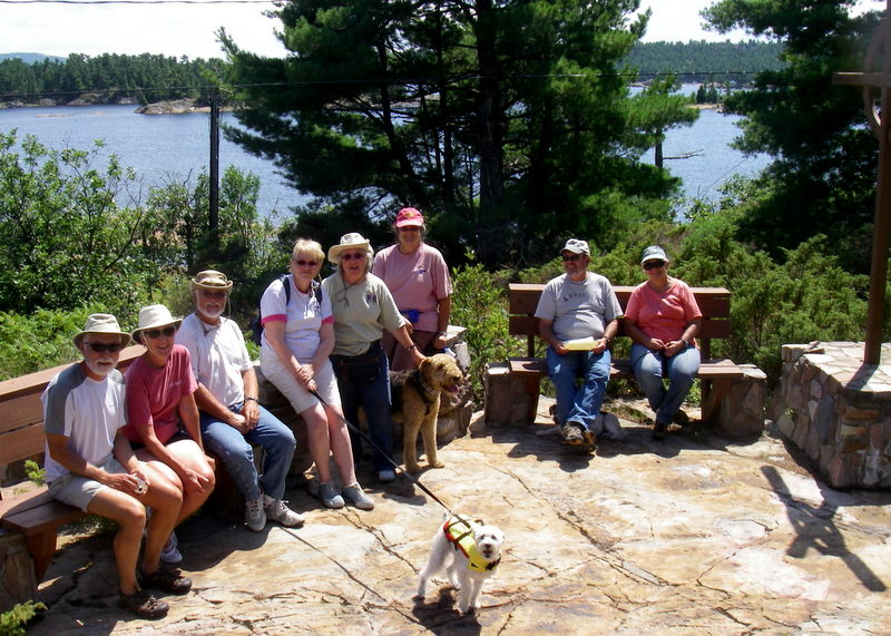 After a few more minor miscues in navigation we make it back to the west end of the East West Channel and are close enough to use our handheld VHF to listen to the GLCC rally announcements. (All of the dinghies with us had 2 to 6 horsepower engines so our speed was limited -- our 3 hour tour turned out to take 6 hours.).
That evening at the cocktail party we meet Ron Dwelle who used to drive Rascal (our boat prior to Toucan) before we purchased her back in the 80s from Steve Black. At the cocktail party, there is a grungy hat award which Craig won with his 2004 Hook Race Mount Gay hat. On Sunday he wears another cap and Mel from Class Act, the judge, said he would have won with that one as well. There are even worst ones still on Toucan. Craigs haberdashery needs help.
Saturday, we pass on the dinghy tours as we are one of the host boats for Saturdays cocktail party and Day wants to make sure that we at least picked up, but we´re lured into blueberry picking by Fairy Tale. While picking 3 plus cups of blueberries, Day sees a mink (or some type of weasel) and Craig sees 3 beavers. When we return with our blueberries, we pick up, clean down below, wash the deck and dress ship with our racing flags (we don´t have any cruising flags). The Captain and crew from Teds Toy 2 -- Ted and Fern Youngs and their daughter, Katherine and husband, Harold -- join us for cocktails on host night (the rains comes, we have our cocktails down below). Ted and Fern have been coming up to the North Channel for over 25 years and we have a very enjoyable evening listening to the adventures. We only hope we are as active when we are 80. After they leave, Day tries to go forward to take the flags down but the heavens open up and give her a bath. The flags go into the anchor well to be retrieved the next day.
 On Sunday there are kayak and dinghy races. Day had said she wouldn't participate in the kayak race but feels compelled to participate, finishing last but she at least makes it across the finish line, half of a leg behind everyone else. In the dinghy race (two legs of rowing and a leg of using the motor) we do better and are second. In the second dinghy race (all motoring), we show our true colors and are last.
Later, while Day is cutting onions for the Hot Dog Roast and Craig is pouring gas into the genny, a nasty wind keeps building and Toucan, deciding that she doesn´t like where we are anchored, pulls the anchor free. Craig notices that we are dragging just before Venetia yells over to us, her voice really carries and upwind at that. Time for our disaster, this is not a drill, drill. Onions and gas forgotten (fortunately neither spilled over), Day grabs the headsets, turns on the windlass and races forward to get the anchor up and Craig gets the engine started and they both get the anchor up and secured. The wind (up to 29 knot gusts) is coming straight at us, the dinghy is tied horizontal to the stern, and the kayaks are floating free on either side of the stern on their tethers. Now we´ve got to get our stuff in order. Day starts to move one of the kayaks forward when it flips vertical so Craig gives Day the helm, goes forward and gets both kayaks on board and then frees the dinghy to trail behind. After scouting the area for a suitable anchorage and finding none that we are happy with, we leave and head west.  We first look at a protected bay just west of the East End but Invictus is in there and there just isn´t room for another boat. We continue west and finally anchor easily out of the wind in the same spot we were in last Wednesday. Day finishes chopping the onions and makes a blueberry dessert to pass, Craig finishes gassing up the genny. Then we gather the necessities -- beer, vodka coolers, plates and utensils for the hot dog roast and head back east. With all the commotion, we are only five minutes late but forget chairs, marshmallows and songbooks. Once again we are one of the last to leave.

 Today´s trip is not all that long, 7.5 miles, but not that easy to navigate. We have to reverse our trip on Thursday to get back to the Pointe Au Baril turning buoy (it is still cloudy and windy but at least the waves aren´t as high) and then reenter Pointe Au Baril, only to heading east. This time Craig has to steer 104 1/2 degrees (really, 104 and one half degrees) following a range until he has to veer to miss an island. There Day has to decide why 2 buoys aren't on the chart. Once she found her way, the rest of the way is straight forward until we are to turn between Stairs Island and Eureka Point. One of the GLCC navigational aids had the Latitude and Longitude on land (obviously an error), so we circled until we could figure where we are and where we want to go.
  This time it takes us 3 tries to get the anchor set. Except for the boats going from one cottage to another, this is another quiet anchorage. After Day makes bread, we dinghy around "Eureka Island" and were going to go to get ice cream but the wind and waves are making it so cold, we stay near shore viewing the huge cottages. One of the smaller cottages has a helicopter on its dock which took off Monday morning -- to work, poor guy. At the far end of the island there is a narrow passage between two islands which leads us back to Toucan. In the passage there is a sand beach where and 5 or 6 boats are partying. For some reason there is no 4th of July fireworks here.


 A fun passage for Craig but Day sat staring at the following seas, the up and down horizon and the dinghy moving side to side and up and down behind us and gets a minor case of mal de mer. She survives but much to Craig's delight it keeps her quiet.
  As soon as we approach the entrance to the Small-Craft Route and head towards the anchorage, the wind dies and the rain hits. Working our way to the Northeast Anchorage in the Bustard Islands we find 3 boats already anchored there -- Stranger, Windigo, a T28, and Muddy Wench -- a Macgregor 26 but there is still plenty of room. Two boats, R-Leg-A-Sea (Jeanneau 37) and Imagine (Beneteau 42), arrive 1 1/2 hours later. Craig and Cindy, from Windigo, dinghy by asking if we knew where to catch fish. We wish!

 We do the usual: kayak for a while and then get in the dinghy. We dinghy to Keyhole Island to see who is there -- 3 sailboats and 1 powerboat and then to the next cove for blueberries and finally over to Chikanishing River where we hike the trail to where it overlooks Georgian Bay and find enough blueberries for muffins and pancakes -- 3 plus cups. On the trail, we meet and talk with Dove Cay and Rudder Nonsense and the rest of the group from the sailboats in our anchorage. They are all hiking in the opposite direction and tell us of a bear they saw also picking blueberries. We missed him.
 After breakfast with Manitou at the Anchor Inn, we head up to the Cruisers Net to listen to the broadcast and to introduce Jim and Ann to Roy. Day then spends the day shopping and Craig finishes some projects on Toucan and does some cleaning. After we take some of our extra junk to IRV, get gasoline for the dinghy and generator, gas costs less on shore than at the docks, and eat another late meal, Amadeus comes over to see how the GLCC harbor reports work on the computer (they´re considering rejoining). Just before closing, we head up with Manitou for ice cream but just as Day starts eating her ice cream, she realizes that she forgot to lock Irv. Jim, from Manitou, and Craig head out to Harbor Vue to check on Irv and Day spends some time with Kismet, another Catalina 380, on the docks. Later Day heads over to Dragonfly to invite Gerry and Robin, his daughter, over for wine when Craig gets back. Dragonfly gets to Toucan before Craig gets back so Day and Gerry start tackling the wine without him. Craig finally makes it back before the wine is finished (he and Jim had a problem taking the Saab back to Spider Bay -- they needed a tool they didn´t have to disconnect the battery ).
 Jim really liked that one. Looking astern we see 4 powerboats coming behind us coming on fast. Thank goodness, they don´t try to pass us in the narrow passages but they do follow us all of the way into our favorite anchorage. (Hopefully they knew about it before and we didn´t give it away). When we reach our anchorage, we find 3 other sailboats (one had 2 anchors out and took up a quarter of the anchorage -- real neighborly). The other two sailboats are anchored and tied to shore) and one powerboat. We drop the hook at 14:15 and set it on the first try. The 4 powerboats that followed us in finally get anchored around 16:00 providing several hours of entertainment.

 By the time we return, six more boats have arrived and are anchored near us. Seven more are anchored further east and 3 are anchored in the West Channel and there are more to come. That evening, there is an impromptu cocktail party on shore.