July 1, 2008 -- East Rous Island to Sturgeon Cove
 Time to move on. After listening to the first installment of the Cruisers Net (We found out that our radio was not transmitting very well. In fact, Blue Heron had to relay our call to Roy). It was also Canada Day so a lot of local boats were out there. After checking out the radio, we upped anchor and headed north through the Waubuno Channel. We weren't sure where we were headed but we were sailing, (passing a sailboat from Waukegan (Otter) as we headed north). When we got to the head of the Waubuno Channel, we had a decision to make, beat upwind to the west or sail downwind toward the east. We're cruisers so downwind it is. We had always wanted to try to get into Sturgeon Cove so why not now.
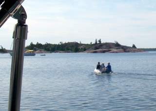
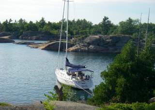
Sturgeon Cove is one of those coves whose entrance is full of rocks. Once you get in it's a well protected cove that is larger than you would think. Lots of wildlife and picturesque but getting in is a challenge. Most of the rocks are underwater but close enough to the surface to bite and are distributed throughout the mouth of the cove. To help sailors get in, Great Lakes Cruising Club has set up 3 homemade range lines in the form of a Z with tight turns at an exact spot. We got in but slowly. It took us two tries to get the anchor down but it was set but good. Only 3 other boats were in the cove; seemed too good to be true. After a beer we tried some fishing -- no luck. Supposedly there is a porcupine that occupies the southeast corner of the anchorage. Spitfire (a sailboat from Ontario, not Waukegan) came in after us and when Bliss, a 51 foot C&C, left asked if we wanted spot before they moved. People are considerate in the North Channel. Apparently she is the editor of the Ports Cruising Guides. Entertainment for the evening included watching some elderly men from a powerboat in the cove taking a bath, i.e. no swimming suits. A sight we could have done without.
July 2 - 3, 2008 -- Sturgeon Cove
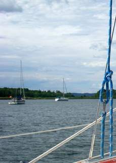
 We had a pleasant two days in Sturgeon Cove: fishing, blueberry picking, hiking, and hanging out. Craig hooked some small bass but no keepers. Blueberry picking was superb. In two trips to shore, we had way over a pint of delectable blueberries. Of course, bears like blueberries too (we could tell by the scat). Then Day saw a mother bear with her two cubs. They were too far down the shore for a good picture (which was not an entirely bad thing). We also met Greg, anchored out with his wife in his boat Moon Shadow, who among other duties is the harbormaster at Little Current. I guess even harbormasters get some time off to go sailing. On the 3rd, Day decided that we both needed to wash and as we were by ourselves we could skinny dip. As it was cold Day did not last very long so she was out of the water quickly and, when she looked up, she saw a sailboat getting ready to enter. She called to Craig then handed him a towel. It was a very dreary day with 1 foot waves washing over the entrance rocks creating a 4 foot depth in areas. The sailboat made it in barely missing the rocks -- They didn't know how close they came (until the next morning).
July 4, 2008 -- Sturgeon Cove to Port of Little Current docks
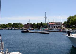
Day got up before Craig and was in time to see the other sailboat leave. She did a quick maneuver as she left and with the sun behind her could see the rocks they had barely missed the evening. As we wanted to give Roy a Winthrop Harbor Yacht Club flag for his wall and do some shopping plus on Saturdays, the Little Current Yacht Club sponsors a boating related seminar and we wanted to attend this one on VHF and Ham radios. So, we cut our stay short and headed out. With the sun at our back and semi calm water we could really see the rocks we missed by following the convoluted path on our way out. As we headed down the Waubuno Channel, we sailed some (to the red buoy just off of the Little Current docks), motored some and finally arrived in Little Current. After we got in and attached the shore power, Craig redid the radio connections in the bilge to see if that would help our transmission problems -- it seemed to. Day left to do laundry.
July 5, 2008 -- Port of Little Current docks to East Rous Island
In the morning, we helped Roy out with the Cruisers Net and gave him a Winthrop Harbor Yacht Club flag for his wall. After the net Roy offered to come down to Toucan to check out our VHF radio. While it didn't test out perfectly, it, at least, was within normal bounds. We talked to Blue Heron for awhile, missed the farmers market and then went to the radio seminar. It was a great presentation, given by Brian's Dad. Day said she almost got more information at this seminar than she learned taking the exams. Now she is ready to try out her new portable ham radio.
 However, we had to go shopping to reprovision and buy some wine in a box for the Happy Hours. Red wine makes sense on a boat as you can screw the lid back on and you don't have to keep it cold. As always we hoped to accomplish too much and only got half done before it got too late.
East Rous is getting a little too familiar but it is a convenient stop close to Little Current. We only stopped for the evening. Once again there was only one boat sharing the anchorage with us. Where is everybody?
July 6, 2008 -- East Rous Island to Fox Harbour
We woke up to a nice southwest wind and after listening to the Cruisers Net and Manitoulin Island Ham club's net (Day was able to dial in her ham portable to the nearest "repeater"), we decided to sail west. We left East Rous by going, carefully, between Mink and the adjacent Blake Island and then sailing west toward Clapperton Island. We then headed north between Clapperton and Amedroz Islands toward the "Main Channel" the same time the Little Current Yacht Club racing fleet (11 boats were racing from Gore Bay to Little Current) were heading south. The sight of the fleet brought back memories of racing but not enough to make us give up our cruising to join them. They even had a cruising section.
 We had a great sail with winds from the WSW as be headed north towards the Benjamins. As we turned west to go north of Clapperton the winds got very strange. We finally had to turn on the motor as the wind changed with us as we tacked up the channel. At the head of the channel it was decision time. Last year Fox Harbour was packed but this year there was only one boat. We decided to try it and to tie the stern to shore. We had a very interesting time of it with a too short line and steep shore. But we persevered and finally got the boat squared away and secure.
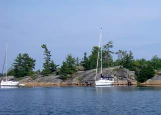
Fox Harbour is a narrow, (e.g. tie to shore) well protected harbor that is interesting to get in to. It is not that difficult if you follow the GLCC's instructions. However, there are big, just barely submerged boulders ready to get you if you go just slightly off course. The harbor is well protected. During the time we stayed, we experienced all kinds of winds with no problems. There are a couple of milk jugs marking rocks farther in the harbor.
July 7 - 8, 2008 -- Fox Harbour on Fox Island
 We spent two days in Fox Harbour exploring and socializing. A couple boats arrived, one anchoring near us, also tying to shore. During cocktails, we found out that this was also their first time. While we were talking, two Blue Herons flew over us letting out a noise that scared the bajebbers out of us. The next day we got into the dinghy to explore Fox Island and to dinghy over to The Benjamins to see what was going on. We went through a very narrow channel north of the large boat entrance and actually poled our way when it was narrow. What a beautiful. We did troll a while but no fish. There were two Catalinas anchored in The Bay of The Benjamins (e.g. between North and South Benjamin Islands) so we went over to talk. It turns out that we had met them last year and that they had bought their Catalinas from Sail Place, the same people that we had bought Toucan from. We actually thought that a couple of boats from Fleet 21 were also there. It turns out Team Effort had chartered a couple of boats from Discovery Yachts in Spider Bay.
July 9, 2008 -- Fox Harbour on Fox Island to Gibson Cove
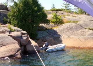
We had an interesting time leaving Fox Harbour -- Day went for a swim while untying from shore. On the way out, with the sun shining, we saw all the rocks that we had missed on the way in. After clearing all of them, we turned north to get around Fox Island and reaching the McBean Channel, we turned east for all of about 2 miles before we turned into Gibson Cove. A nice short little sail to a nice little cove protected from most winds, good holding and located in an area with lots to explore.
July 11, 2008 -- Gibson Cove to Little Current
On July 4, after we found out that Mike and Val were not going to be able to make it up to Little Current, Terry from Blue Herron talked us into signing up, late, for the GLCC Rendezvous. Deb Turner (Turner's store established 1879) was more than happy to take our money and put in our reservation, she was in charge of the Rendezvous and, for some reason July 4 is not a holiday in Canada.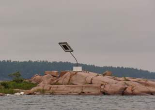
Committed to be in Little Current on July 12 and it being a beautiful day, we left Gibson Cove. It was a fluky day for sailing (looking at the picture it does get windy up here) but we tried sailing north of the islands and down the Waubuno Channel to Little Current.
It was a good thing that we were a day early for the rendezvous as they didn't have us down on the list of those needing slips. However, a boat had just called in saying that they were going to be late so we got their slip. We also found that if we stayed for 5 days we could stay for an additional two days for the same fee. Seeing as we were to pick up Dave and Karen for a 3 hour tour of the North Channel, we signed up for a week at a slip. This was really going to be different as we had only stayed at a slip for one night since June 16.
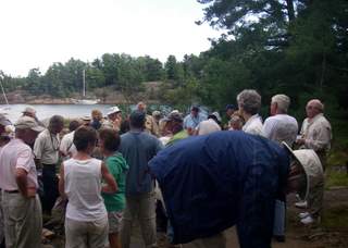
July 12 - 17, 2008 -- Great Lakes Cruising Club Rendezvous in Little Current
 We had a lot more fun at the rendezvous than we expected, thank you Terry. We met a lot of good people, leaned a lot about the cruising club and cruising the North Channel and thoroughly enjoyed the breakfasts, the cocktail parties, and the pot-lucks The final banquet, whitefish, was the best meal we have had in a long time but the speeches were a little tedious.
The extra day at the slip was spent shopping and doing laundry, necessary evils.
Dave must be near. It started raining for the first time July 17. Dave and Karen showed up at about 10:00. It did stop raining enough to get their gear on the boat.
July 19, 2008 -- Browning Cove to Marianne Cove
Not much wind, Karen's fault, so we decided to go to Baie Fine which was closer than other options. We motored in through the passage and noticed that there were few boats anchored in Marianne Cove. We stopped and anchored.
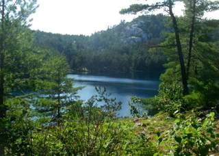 After getting the anchor set (second try) we took the dinghy to the Pool and hiked up to Topaz Lake. Everyone we passed on the way up warned us not to miss the fork in the trail with a yellow sign pointing to Topaz Lake. Dave leading our little party missed the sign but fortunately Day, bringing up the rear saw it before we got too far up the wrong trial. All agreed that Topaz Lake was worth the arduous climb. Once there we swam and picked blueberries before heading back down the trail (just as difficult as the climb up but no sign to miss). There was a group of kids on a canoe trip who joined us as we swam. There were on the second trip down/up their portage from Three Narrows Lake to The Pool. They had left their back packs at the sign leading to Topaz Lake. The portage is a rigorous one.
At the end of the day a few trailer sailors joined us in the cove. Fortunately it wasn't the whole group as I think there over 20 cruising the North Channel this week.
July 20, 2008 -- Marianne Cove to Louisa Island via Little Current
It rained that night so we decided to leave the climb to Caisons Peak for another day and, after getting out of Baie Fine we decided to sail west, slowly. We stopped in Little Current for more provisions and moved on, up the Waubuno Channel to Louisa Island.
Louisa, a new harbor for us, is a cove with a sand beach and flat rocks for cookouts. It's protected from all winds but from the northeast and east. The holding is good and it's easy to anchor in. We also found out that the water in the cove is warmer than the rest of the channel and accordingly is the preferred swimming hole. As for our activities, we sat and rested from our arduous trip. There were a couple of powerboats anchored on shore have a campfire. They left before dusk.
July 21, 2008 -- Louisa Island to South Benjamin Harbour
Dave woke up early and noticed the winds starting to build from the northeast. Craig finally woke up when the winds were blowing 20 -- 25 knots from the northeast and the waves were starting to build (northeast is the direction from which Louisa is not protected). The anchor was holding, but why stay? We Weigh anchor and left for the Benjamin Island group. An interesting note was when we called into the Cruisers Net and told them the wind we had they didn't believe us at first -- the winds were calm elsewhere in the channel. Finally, June Bug called in from the Notch and confirmed that they had the same wind we had. The winds can be strange in the North Channel.
 With the winds we had, we sailed through the McBean Channel, down the west side of Fox Island and the Benjamin Island Group and anchored in South Benjamin Harbour. It was crowded but the harbor between North and South Benjamin, our other choice, is not good in east winds.
The Benjamins, along with The Pool, is one of the must sees in the North Channel. Dave and Karen hiked the islands while we toured by dinghy. It's worth the trip. We found another spot to anchor if you are not faint of heart -- a secluded spot for one boat only. Maybe we will get courageous next year.
July 23, 2008 -- East Rous Island to Beaver Island Harbour via Little Current
We were up, early and made it to Little Current by 7:10. We had to have breakfast at the Anchor Inn and introduce Dave and Karen to Roy (to whom they've been listening to for the last week). So long to an early start.
Dave and Karen left at about 09:30 and, being in Little Current, we shopped and stopped again at Wallys for the usual services. We made it through the 15:00 bridge and tiring of Browning Cove, we headed down the Strawberry Channel for Beaver Island Harbour.
Beaver Island Harbour is a large anchorage between Beaver Island and Strawberry Island. It is a well protected harbor with good fishing but not much hiking. We were the only boat in the anchorage for awhile but two boats joined us later on. Of course with the entire anchorage to choose from, they anchored close by us.
July 24, 2008 -- Beaver Island Harbour to Keyhole Island in Collins Inlet
 We left Beaver heading toward the GLCC Wilderness Rally by Keyhole Island in Collins inlet. We decided to take the direct course to Georgian Bay (another first) going south of Badgeley Island et al and skip Killarney. With a variable wind (0 to 10 knots) we sailed, motored, motor sailed to the entrance to Collins Inlet, the start/end of the Georgian Bay Small Craft Route. Keyhole is only a mile or two in from the entrance to the small craft route and we were there before we knew it. The anchorage was pretty full with Rallyists but we were able to find a good spot about midway through the anchorage.
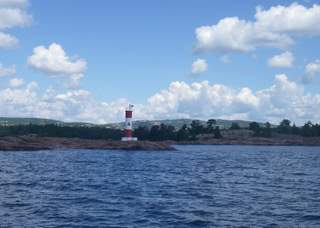
The anchorage for the Rally was actually to the north of the no name island just to the west of Keyhole Island. Made sense to us. The anchorage is large enough to hold the 40+ boats that attended the Rally but small enough to offer good protection in all winds. In fact, we weathered a 30 knot blow with the other 40 boats with no problems. The anchorage is close to Chikanishing River, which has a nature walk and several other islands, rocks and hills to explore.
July 25 - 28, 2008 -- GLCC Wilderness Rally in Collins Inlet
 Once again, we thoroughly enjoyed the Rally with the cocktail parties and cookouts on the shore and the various excursions. We even took part in the dinghy races (handicapped by motor HP) and the blindfolded dinghy rowing race (Craig rowed, Day gave directions (no change from normal but she couldn't talk), Craig didn't follow directions and forgot what he was supposed to do when Day gave the correct direction -- Craig had set the rules. We took second in both. The dinghy excursion to Chikanishing River was fun plus we found blueberries. We did see another Bald Eagle.
We stayed at Keyhole for a couple extra days to meet with Manitou from Milwaukee. They wanted to make the Rally but issues arose, like weather, and they were going to be a day late. We got together when they arrived for cocktails and dinner and had a wonderful time talking about cruising and joining us the next morning for coffee and the Cruisers Net.
July 29, 2008 -- Keyhole Inlet to Mill Lake
 Everybody said that we had to continue on through Collins Inlet, a narrow passage through the granite that sometimes is as narrow as 25 to 50 yards. The only problem is the depth at the exit of Collins Inlet to Beaverstone Bay. We had heard reports that the depth at this exit was about 6.5 feet so off we went. The other problem is you have to motor the whole way but so what.
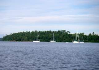
The inlet was beautiful and well worth the trip. It is narrow but the scenery is something else. About half way through, Collins inlet opens up into Mill Lake -- a good anchorage and supposedly good bass fishing. We tried to get into 10-15 foot depth but the weeds were so thick they completely wrapped around our keel, rudder and prop and we almost came to a complete stop. Fortunately we were able to get out of this area into 20 foot depths just west of the north edge of Green Island, with no or little weeds and got the anchor down. Craig dove under the boat and cleared tons of weeds of off the prop; we had reversed to get them off of the rudder and keel.
July 31, 2008 -- Mill Lake to the Bustard Islands
Leaving Mill Lake, we continued on through Collins Inlet to Beaverstone Bay. It really looks different on Toucan than it did in the dinghy -- the granite boulders are much closer. This part of the passage was just as narrow and as pretty as the first but a little shorter. The east end of the inlet empties into Beaverstone Bay and was known to be shallow but the latest reports that we heard was the depth was not less than 6.5 feet. The reports proved to be true and we made it through slowly.
Once out of Collins Inlet we had to find our way out of Beaverstone Bay. With the small craft route charts it wasn't that difficult but we had to pay attention to where we were. Beaverstone Bay is pretty with lots of rocks and islands and a few anchorages. We didn't stop as we were heading for the Bustard Islands.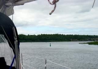
Imagine our surprise when we got out into Georgian Bay and found that our chart plotter didn't have charts for this part of Georgian Bay. We then found that the charts that we had only showed the Bustards at the southern most edge and the only other chart we had of Georgian Bay was a large scale chart of the whole Bay. We figured we had enough to at least get into the Bustards using old fashioned navigation (non-electronic). Plotting our course and sighting the rocks and lighthouses, we made it through the "Gun Barrel" passed to north of Pearl Island and west of Green Island, then anchored tying our stern off to the shore.

The Bustard Islands are a popular anchorage in Georgian Bay where there are several places to anchor. We anchored in the round bay south of Pearl Island. At first, we thought could swing at anchor but as the anchorage is rather small we finally tied our stern to shore so we wouldn't swing out into another boat. We didn't explore much while we were there but we hope to come back soon.

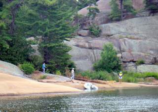
 We took the dinghy out and looked around the part of Fox Island that we didn't explore while we were in Fox Harbour. We landed on a rock and hiked across a narrow part of Fox Island. On the other side we were able to look down the channel between the Benjamins and Croker and see all the rocks. This channel is supposedly passable but not for us. By the way, there were lots of "almost ripe" Blueberries but we couldn't stay. Places to go; things to see. We did get fascinated with the geology on the shore. Veins of pink strands in black rock.